
Hovis Cycle Maps, 1899 to 2012

Hovis, the bread company, is making good use of its brand ambassador and Olympic gold medallist, Victoria Pendleton. She’s been working with Hovis since 2010 and is now fronting a campaign to get more people on bikes via a series of cycle route maps. The 16 digital routes are overlays on Google Maps and feature supposed bon mottes from Victoria herself, such as: “Discover Gibside’s stunning 18th century landscape garden and haven for nature on this route.”
The ‘Hovis Cycle Maps’ promotion is being flagged on packs of the baker’s wholemeal bread. Hovis has a long history of supporting cycling. Before Sky took over sponsorship, turning it into the SkyRide, Hovis ponied up £1.5m to sponsor the London Freewheel ride. In the 1990s the bread brand supported the National Byway with £500,000.
Of course, the bread brand’s most famous connection with cycling is the 1973 ‘Boy on a bike’ TV advert produced by director Ridley Scott. This was set against Dvorak’s New World symphony, rearranged for brass, and featured a delivery boy freewheeling down a cobbled northern hill. (In fact, the ad was shot on Gold Hill of Shaftesbury, Dorset).
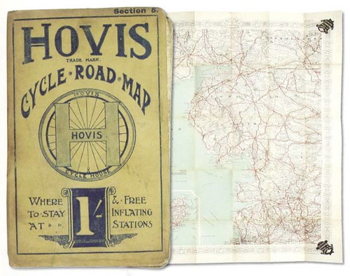
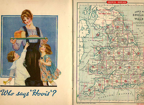
But the Hovis connection with cycling goes back much further. In 1899 Hovis launched a series of eight cycle road maps covering England and Wales. Each map listed hostelries that served Hovis bread. These guest houses displayed a tin-plate sign with a cycle wheel and the letter ‘H’ for Hovis.
This idea was ‘borrowed’ from the CTC. Since 1888 the Cyclists’ Touring Club had produced 24in-diameter cast-iron ‘winged wheel’ plaques which could be displayed on the exterior of hotels and other businesses to advertise the fact special offers awaited CTC members. Hundreds of these heavy signs were on display across the UK. They were of such high quality many are today still affixed to buildings.
The maps were published by G Philip and Son and the co-sponsor was the Cycling Components Mfring Co, Birmingham. The Hovis-sponsored map series continued for 25+ years.
Hovis was one of many sponsors of maps for cyclists at the end of the 19th Century. Cycling was an incredibly popular aristocratic and middle class activity in the 1880s and early 1890s and there were a great many paid-for and free maps and itineraries aimed at this late Victorian demographic.
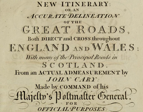
The early itinerary road books, produced by cyclists for cyclists, were the first ‘road maps’ for a generation. They were updates of the 1798 ‘New Itinerary’, produced by map maker John Cary working on commission from Britain’s Postmaster General. Cary’s work – subtitled ‘An Accurate Delineation of the Great Roads, Both Direct and Cross, throughout England and Wales’ – contained maps, distances between towns, and stagecoach routes. When railways killed off the stagecoach trade in the 1830s and 1840s, there was little use for maps of Britain’s road network (and little use for roads, too); until the cyclists came along.
Cyclists breathed new life into British roads, and there was an explosion in cycling-specific maps. Here are just a few examples…
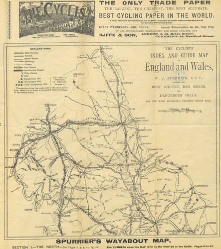
Spurrier’s Wayabout Map, produced in the 1890s by W. J. Spurrier of the CTC, contained “the best routes, bad roads and dangerous hills.”

The Bicycle Roadbook by Charles Spencer was first published in 1878.
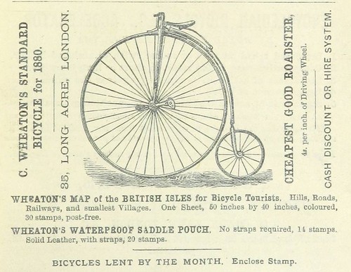
Wheaton’s Map of the British Isles for Bicycle Tourists cost “30 stamps, post free” and was produced by C. Wheaton, a Covent Garden maker of high wheelers.
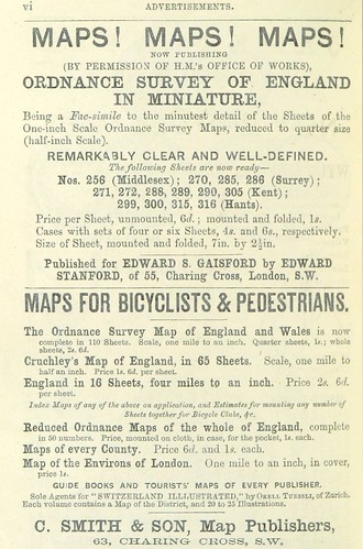
Edward Gaisford of Charing Cross produced quarter size versions of the one inch Ordnance Survey maps and Cruchley’s Map of England came in 65 sheets at the one inch scale or sixteen sheets at the four miles to an inch scale.
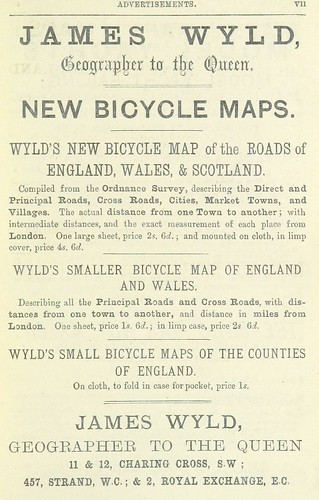
James Wyld – “geographer to the queen” – produced Wyld’s New Bicycle Map of the Roads of England, Wales and Scotland which was “mounted on cloth, in limp cover” for the cyclist seeking to cover a lot of ground. Wyld also produced county maps for those cyclists with more modest distance ambitions.
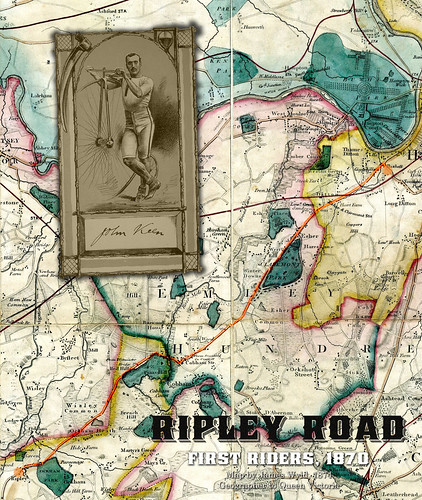
The map on this graphic is an extract from a Surrey map produced in 1874 by Wyld. Ripley Road was the “best cycling highway in the world” in the 1880s and 1890s.